# DAY XII : Spangmik-Hanle
#94. We were supposed to
travel on the dirt gravel track from Spangmik to Hanle covering the villages of
Maan, ,Meraak and finally Chushul before reaching Hanle. The route immediately
after leaving the village of Spangmik deteriorated and was full of rocks and dried
mountain streams. By 0730 we were on our way . The going was really slow as we
had to chart the route very carefully considering the obstacles ahaead.The
route was along the Pangong and by 0830 we were at Maan.
#95. Here we had to make
a decision of whether to continue on the route ahead else turn back and move
towards Hanle via the Erath route. Considering the time that we had taken to
cover close to nine Kms and having a pre conceived notion based on inputs that
the Erath Route was tarred and easy to cover , we turned back as reaching Hanle
was more important. I was faced with many decisions out here for there were so
many lakes to be seen in this region and also some iconic routes but whether we
could see what we wanted to depended on time and space .
#96. Anyhow we turned
back and retraced the path towards Spangmik. Afer Spangmik I gunned the
INDOMITABLE towards Tangtse as we had to reach there and then turn towards
Erath. I reached Tang tse by 1030 and for few minutes I just stopped the
vehicle and debated whether to head back to Leh and then return via the
Changthang route or to push on the Erath route . The decision had to be made at
this crossroad for time and distance were playing a factor in this .
#97. Somehow we decided
to move ahead on the Erath route towards Hanle. My vision of a tarred road disintegrated
immediately as I passed throught a sector undergoing road construction and
hence could absolutely make no speed for then the tyres would take a beating.
After a agonizing 17 km I finally was clear of the under construction sector
and came across something of a beauty – Harong
Wetlands.This is a marvelous high altitude eco system and sustains multiple
plants and birds who co exist peacefully.
#98. The beauty of this
place was such that in spite of my tearing hurry I could not make haste and
spent close to 30 minutes just soaking in the pretty picture of herds of Yak
grazing on the yellow vegetation under the cover of snow cloud mountains while
geese and other aquatic birds played in the glacial streams .It was the setting
of a perfect idyllic morning and if I was not destined to cover such a large
journey I would stayed at this place for the day itself.
#99. We had to leave such
a magical place with a heavy heart and proceed ahead. The road condition had
improved and we made good pace and soon reached Parma. The TCP out here allowed
us to proceed only after we were able to show some proper documentation, hence
it is important to note that maybe without proper permits this road too might
not be accessible if one needs to reach Chushul . After Parma the road just
disappeared and for the next 60 Kms it
was a total dirt track under construction hence the progress was agonisingly
slow . I had reached the limits of my patience as I desperately wanted to reach
Chushul for the route to Tsaga La was still to be covered.
#100. The INDOMITABLE
literally crawled on the heavy dirt tracks sliding sideways many a time on the
heavy dirt that was present. The heat also kept building up and with no road
markers or signs I had no idea about how far was chushul and had to
increasingly rely on the GREF crews for references.Chushul was finally reached
in the afternoon midday heat at 1400 hrs.
#101. After a short break
of 10 minutes and showing our permits to the Indian Army personnel at the TCP
we proceeded ahead towards Rezang La . Out ideas of visiting Mirpal Tso were
totally shelved as I was literally clawing for time. This sector definitely
needs time and patience and I was running out on both of them. I realized I
need to be flexible but this was an afterthought and at that point I was just
concentrating on Hanle.
#102. From Chushul the
route to Hanle comprises of two sections , the first is the totally dirt track
through extreme wilderness along the Rezang La and Spangur Gap which mark the
fringes of the LOC with China. This sector continues till Tsaga La after which
we reach the village of Chagga where we meet the tarred road which then
continues all the way till Hanle.
#103. Firstly about the
route till Tsaga La. This route is one of the few remaining total wilderness
routes when it comes to tourists, with no road except a dirt track made by the
vehicles which ply on these paths, one has to be careful while transgressing this route as there are
no markers to indicate just about anything .One can see the bunkers of the
Indian Army on the right who stand guard the safety and sovereignty of our
country against possible incursions from across the border. On the left the
Rezang La mastiff rises and acts as the natural barrier for the LOC. It was
here that the 1962 war was so fiercely fought and lost. The memorials at
Chushul and at Rezang La bear testimony to the sacrifice and valor. There are
no grand monuments constructed by the grateful nation in recognizing the
sacrifice, no wreaths laid by National Leaders to commemorate the sacrifices ,
its only the Indian Army who still remembers and honors those who were a part
of the family and are no more . Very poignant thought but that’s the reality in
this country of ours.
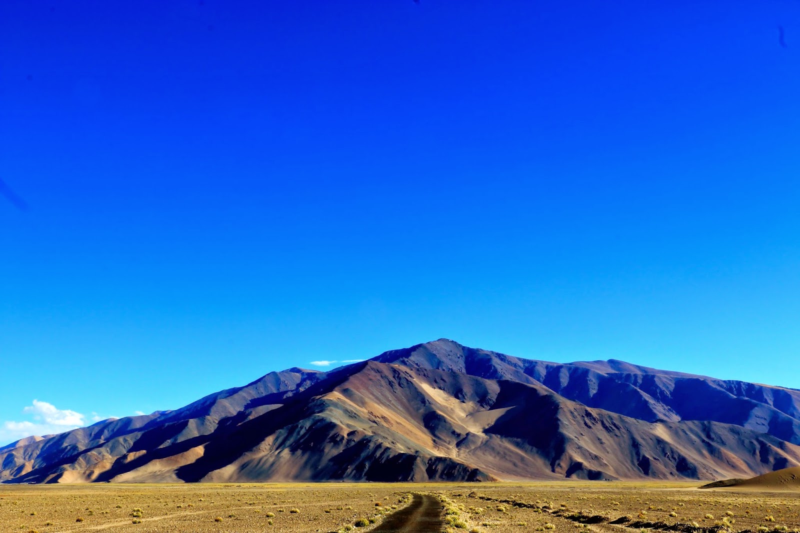
#104. The scenic beauty on
this sector is simply awesome whatever be the season, teeming with wildlife
this is a place that makes one realize the seclusion that Ladakh once
possessed. There are one two streams that need to be crossed which are a
challenge to the INDOMITABLE but we were able to move on. The trick is to stay
in sight of the telephone cables which are your markers and they will show one
the path ahead J
#105. Tsaga La was reached
by 1550 hrs and thereafter we crossed the ITBP TCP and for the first time in
many hours stepped on smooth tarred road. The Indomitable roared ahead and we
were on our way and what a change of scenic beauty , multicolored mountains
welcomed us as we sped on our way towards Loma Bend which was reached by 1700
hrs.
#106. The distance of Hanle
from Loma Bend is 55 km and immediately after the bend there is a bridge ,
beyond the bridge there is a V junction. The left takes one to Fuckche while
the right goes to Rhongo and then to Hanle . The road surface is as smooth as
the More plains and we were speeding on our way in the setting sun as it has
been a really long day and wanted to reach the village before the sun set.
#107. Hanle was reached by 1830
and the path to the village is different from the one which goes to the Hanle
Gompa. The diversion to Photi La is also out here and is distinctly marked. The
road construction is on at Photi La as per reports from the GREF teams who are
at work out there.
#108. So here we were at
the extremities of Ladakh away from the hordes of toursuts who come tripping to
Ladakh , here we were among those who actually inhabit this wonderful land and
live their lives in peace. ODO for the day read 75900.
 |
PRETTY HARNONG WET LANDS |
 |
REFLECTIONS OF BEAUTY |
 |
FLIGHT OVER WATER |
 |
MIGHTY PANGONG |
 |
CHUSHUL MEMORIAL |

 |
THE ROAD TO CHAGGA LA |
 |
FINALLY |

 |
FLIGHT IN FREEDOM |
 |
HANLE GOMPA , SOUTH EAST LADAKH |
 |
DO I NEED TO COMMENT |


 |
THE BEAUTY AT HANRONG |

 |
AT PLACES HARDLY VENTURED |
 |
OVER DUSTY FORGOTTTEN TRACKS |
 |
HE LOOKS |
 |
WE WERE THE VISITORS |
 |
THE KIANG , IN LADAKH |


 |
PERSPECTIVE |


 |
COLOURS AT HANLE |

 |
NO TRACKS OTHER THAN THESE |

Beautiful place, lovely photographs!
ReplyDelete