Nandikund to Manpai Bugyal
54. The next day we decided to press on and by seven thirty in
the morning, Umeid and me were on the way while the rest of the team would
follow. We made good progress and the first target was to ascent Ghia
Vinayak Pass. The pass was marked by the egress from the cavity that
Nandikund lay in and we moved in that direction .The route was extremely brutal
and treacherous and involved walking or rather I would say hopping over huge
boulders and to do this without a guide is definitely not even to be thought of
, it is so easy to get lost out here and wander off into the various trails
that lead into the surrounding mountains and there is no coming back from them
.We would have covered a distance of 2.5 km uphill till we reached elevation 4712 mts which was at the pass and from
here one could see the entire Himalayan Range including Nanda Devi , Nanda
Ghunti , trishul and other glittering peaks …
55. We waited for the rest of the team and then after offering
prayers we descended the pass and I looked back once towards the lake which was
not visible anymore and with a sense of sadness turned my back towards it and
moved ahead as I pass through the region of the high mountains towards the
forest that awaited us.
56. The descent from Ghia Vinayak was also treacherous and
totally boulder ridden as I picked my way slowly and we reach Vaitrani
covering a distance of around 2.0 km which marked the base of the descent.
Elevation recorded was 4335 mts.
From here the walking was faster as we were crossing rolling hills, the elevation
dropped sharply and soon we reached Barma and then Kiel which was 2.0 km ahead.
Elevation recorded was 3713 mts. The effects of the 2013
disaster were visible here too as there were huge cracks and fissures that had
opened up where earlier there was nothing.
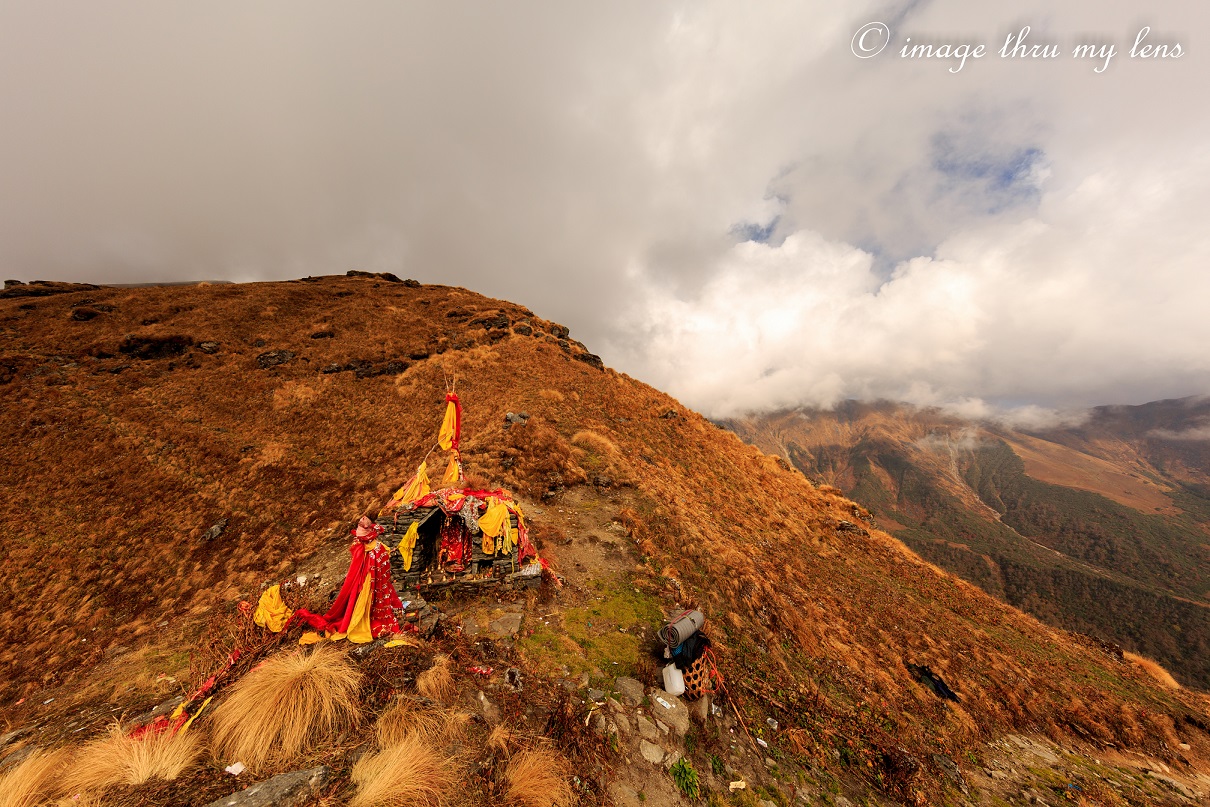
57. The next way point was Achrikona , which had a small shrine
dedicated to the forest goddess , this shrine lay on the mountain slope near to
the summit at an elevation of 3900 mts and was around 2.5 km ahead
of Kiel . We rested for a while and it was early evening but decided to press
on and reach Manpai Bugyal where we would stop for the day. This lay on the
other side of the mountain, a series of meadows and at an elevation of 3670 mts and around three kms ahead.
58. Soon after around an hour and half we reached Manpai Bugyal
and found a good camping site next to flowing water and made camp for the night.
The mood in the camp was very jubilant as it marked the near completion of a
successful trek. I was grateful to nature and circumstances that had allowed me
to see places and vistas that I a year ago had not even heard about but now had
seen and lived through them.


No comments:
Post a Comment