Saturday, 30 April 2016

Nandikund trek :Quest through the Garhwal Himalaya ( Nandikund to Manpai Bugyal )

Nandikund to Manpai Bugyal

54.          The next day we decided to press on and by seven thirty in the morning, Umeid and me were on the way while the rest of the team would follow. We made good progress and the first target was to ascent Ghia Vinayak Pass. The pass was marked by the egress from the cavity that Nandikund lay in and we moved in that direction .The route was extremely brutal and treacherous and involved walking or rather I would say hopping over huge boulders and to do this without a guide is definitely not even to be thought of , it is so easy to get lost out here and wander off into the various trails that lead into the surrounding mountains and there is no coming back from them .We would have covered a distance of 2.5 km uphill till we reached elevation 4712 mts which was at the pass and from here one could see the entire Himalayan Range including Nanda Devi , Nanda Ghunti , trishul and other glittering peaks …

55.          We waited for the rest of the team and then after offering prayers we descended the pass and I looked back once towards the lake which was not visible anymore and with a sense of sadness turned my back towards it and moved ahead as I pass through the region of the high mountains towards the forest that awaited us.

56.          The descent from Ghia Vinayak was also treacherous and totally boulder ridden as I picked my way slowly and we reach Vaitrani covering a distance of around 2.0 km which marked the base of the descent. Elevation recorded was 4335 mts. From here the walking was faster as we were crossing rolling hills, the elevation dropped sharply and soon we reached Barma and then Kiel which was 2.0 km ahead. Elevation recorded was 3713 mts. The effects of the 2013 disaster were visible here too as there were huge cracks and fissures that had opened up where earlier there was nothing.

57.          The next way point was Achrikona , which had a small shrine dedicated to the forest goddess , this shrine lay on the mountain slope near to the summit at an elevation of 3900 mts and was around 2.5 km ahead of Kiel . We rested for a while and it was early evening but decided to press on and reach Manpai Bugyal where we would stop for the day. This lay on the other side of the mountain, a series of meadows and at an elevation of 3670 mts and around three kms ahead.


58.          Soon after around an hour and half we reached Manpai Bugyal and found a good camping site next to flowing water and made camp for the night. The mood in the camp was very jubilant as it marked the near completion of a successful trek. I was grateful to nature and circumstances that had allowed me to see places and vistas that I a year ago had not even heard about but now had seen and lived through them. 


Wednesday, 27 April 2016

Nandikund Trek : Quest through the Garhwal Himalaya ( Pandav sera to Nandikund )

Pandavsera to Nandikund.

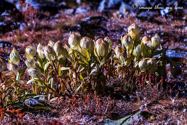
49.          The next morning we started towards Nandikund , the name that I had come across way back sitting in my rickety armchair . We walked around two kms through the valley floor till finally we reached the edge of it and then started the climb yet again. To climb and criss cross mountain ranges and ridges, this is what this trek was majority, it tested the limit and endurance. Elevation read 3900 mts. As we climbed up I came across another unfulfilled wish of mine .. Brahmakamals , so many of them standing tall against the morning sunlight found only in these upper altitudes of the Himalayan ranges. I was indeed fortunate to have come across them. After a climb of around 2 kms we reached the top of the ridge and crossed over leaving Paandav sera behind. Elevation read as 4210 mts.

50.          From here one could see the Kedar dome , Chaukhamba massif and other Himalayan Peaks glittering in the morning sunlight. We pressed forward after a short break for breakfast onwards  towards Nandikund. After a treacherous route through the mountain slopes I descended into the cavity between mountains and there lay NandiKund at an elevation of 4500 mts.

51.          My first sight of the shimmering lake as I came up to it from below was nothing short of magical . All the effort paid off as we were able to reach here and I was congratulated by my guide for the successful mission trek. I was overwhelmed with emotions and I am unable to put it in words, the place moves you and after the walk through rains , mist , snow , ridges ,mountains , forests and desolate countryside one comes to this sight , the lake waiting for those who have the will to reach out here and the traveler is presented with sights that are burnt in his memory for the years to come …
52.          Nandikund , a high altitude lake situated in glacial terrain provides splendid views to those who come here . The lake is fed by the snows all around on the mountains and there is a river that originates from this lake which flows downwards towards pandaav sera and beyond. The afternoon while the team relaxed and made camp I wandered towards the farther end of the lake and just spent time with myself in company of this wondrous living lake , thereafter myself and Umeid climbed a nearby hill to see the views from up higher . As we were descending the mist came in and soon it started snowing. In the evening we wandered in the mist as we  approached towards the lake shore to soak in this magical moment. There is a small shrine built here which is of Maa Nanda Devi and is worshipped by local villagers who come from Urugam and Dumar village yearly once.


53.          That evening there was just me and the team out here and the lake , no one else .. a truly magical moment indeed.